
Saint Francis topographic map
Interactive map
Click on the map to display elevation.
About this map
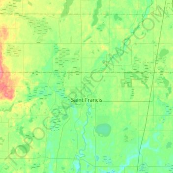
Name: Saint Francis topographic map, elevation, terrain.
Location: Saint Francis, Anoka County, Minnesota, 55070, United States (45.37787 -93.51007 45.42076 -93.26532)
Average elevation: 925 ft
Minimum elevation: 860 ft
Maximum elevation: 1,079 ft
Anoka County trails, hiking, mountain biking, running and outdoor activities
Other topographic maps
Click on a map to view its topography, its elevation and its terrain.