
Gunlock topographic map
Interactive map
Click on the map to display elevation.
About this map
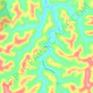
Name: Gunlock topographic map, elevation, terrain.
Location: Gunlock, Magoffin County, Kentucky, 41632, United States (37.52760 -82.94600 37.56760 -82.90600)
Average elevation: 1,198 ft
Minimum elevation: 961 ft
Maximum elevation: 1,519 ft
Other topographic maps
Click on a map to view its topography, its elevation and its terrain.
Epson
United States > Kentucky > Magoffin County
Epson, Magoffin County, Kentucky, United States
Average elevation: 1,056 ft