Geolocate
👉 Easily get elevation data in JSON, GeoTIFF and KML formats using Elevation API
Thank you for supporting this site ❤️
Make a donation

Gear up for your next adventure:

As an Amazon Associate, this site earns from qualifying purchases at no extra cost to you.

President James K. Polk State Historic Site topographic map

Click on the map to display elevation.

About this map

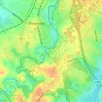
Name: President James K. Polk State Historic Site topographic map, elevation, terrain.

Location: President James K. Polk State Historic Site, Downtown, Pineville, Mecklenburg County, North Carolina, 28134, United States (35.07689 -80.88514 35.07961 -80.88029)

Average elevation: 574 ft

Minimum elevation: 512 ft

Maximum elevation: 627 ft

Mecklenburg County trails, hiking, mountain biking, running and outdoor activities

👉 Easily get elevation data in JSON, GeoTIFF and KML formats using Elevation API
Thank you for supporting this site ❤️
Make a donation

Gear up for your next adventure:

As an Amazon Associate, this site earns from qualifying purchases at no extra cost to you.

Gear up for your next adventure:

🧭Compass with Lanyard - Easy‑carry compass for navigation
🕶️GPS Smartphone Mount - Secure mount for phone navigation
🛠️Outdoor Gear Repair Kit - Essential tools to fix gear on the trail

As an Amazon Associate, this site earns from qualifying purchases at no extra cost to you.