
Ángeles topographic map
Interactive map
Click on the map to display elevation.
About this map
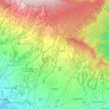
Name: Ángeles topographic map, elevation, terrain.
Average elevation: 5,810 ft
Minimum elevation: 3,743 ft
Maximum elevation: 8,671 ft
Other topographic maps
Click on a map to view its topography, its elevation and its terrain.
Santiago
Costa Rica > Cantón San Rafael
Santiago, Cantón San Rafael, Heredia Province, 40503, Costa Rica
Average elevation: 3,963 ft