
Thank you for supporting this site ❤️
Make a donation
Make a donation
Gear up for your next adventure:
As an Amazon Associate, this site earns from qualifying purchases at no extra cost to you.
Mariazell topographic map
Click on the map to display elevation.
Thank you for supporting this site ❤️
Make a donation
Make a donation
Gear up for your next adventure:
As an Amazon Associate, this site earns from qualifying purchases at no extra cost to you.
About this map
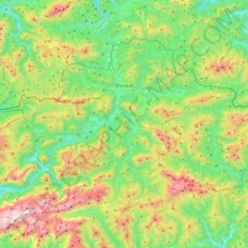
Name: Mariazell topographic map, elevation, terrain.
Location: Mariazell, Bezirk Bruck-Mürzzuschlag, Styria, 8630, Austria (47.62295 15.06696 47.82789 15.50664)
Average elevation: 3,688 ft
Minimum elevation: 1,906 ft
Maximum elevation: 7,375 ft
Thank you for supporting this site ❤️
Make a donation
Make a donation
Gear up for your next adventure:
As an Amazon Associate, this site earns from qualifying purchases at no extra cost to you.