
Charlottenburg-Wilmersdorf topographic map
Interactive map
Click on the map to display elevation.
About this map
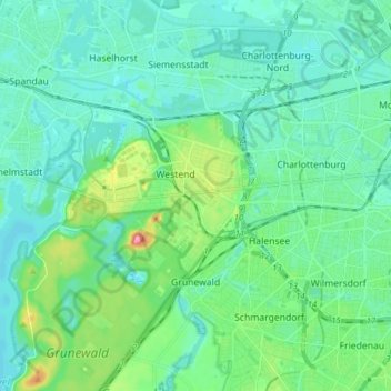
Name: Charlottenburg-Wilmersdorf topographic map, elevation, terrain.
Location: Charlottenburg-Wilmersdorf, Berlin, Germany (52.46646 13.18660 52.54943 13.34143)
Average elevation: 144 ft
Minimum elevation: 85 ft
Maximum elevation: 381 ft
Other topographic maps
Click on a map to view its topography, its elevation and its terrain.
Friedrichshain-Kreuzberg
Friedrichshain-Kreuzberg, Berlin, Germany
Average elevation: 148 ft
Schöneberg
Schöneberg, Tempelhof-Schöneberg, Berlin, Germany
Average elevation: 151 ft