
Bögöt topographic map
Interactive map
Click on the map to display elevation.
About this map
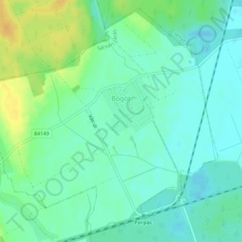
Name: Bögöt topographic map, elevation, terrain.
Average elevation: 568 ft
Minimum elevation: 535 ft
Maximum elevation: 630 ft
Other topographic maps
Click on a map to view its topography, its elevation and its terrain.
Apátistvánfalva
匈牙利 > Vas megye > Apátistvánfalva
Apátistvánfalva, Szentgotthárdi járás, Vas megye, Nyugat-Dunántúl, Dunántúl, 9982, 匈牙利
Average elevation: 981 ft