
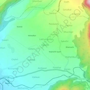
Matehr topographic map
Interactive map
Click on the map to display elevation.
About this map
Name: Matehr topographic map, elevation, terrain.
Average elevation: 3,196 ft
Minimum elevation: 2,835 ft
Maximum elevation: 4,147 ft
Other topographic maps
Click on a map to view its topography, its elevation and its terrain.
Buner
India > Himachal Pradesh > Nagrota Bagwan
Buner, Nagrota Bagwan, Kangra District, Himachal Pradesh, 176047, India
Average elevation: 2,854 ft
Khasmasal
India > Himachal Pradesh > Nagrota Bagwan > Khasmasal
Khasmasal, Nagrota Bagwan, Kangra, Himachal Pradesh, 176047, India
Average elevation: 3,156 ft