
Hateg topographic map
Interactive map
Click on the map to display elevation.
About this map
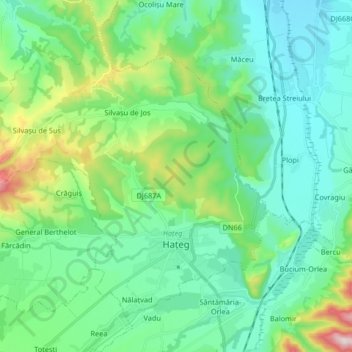
Name: Hateg topographic map, elevation, terrain.
Location: Hateg, Hunedoara, Romania (45.58576 22.82712 45.67775 22.99178)
Average elevation: 1,198 ft
Minimum elevation: 820 ft
Maximum elevation: 2,520 ft
Other topographic maps
Click on a map to view its topography, its elevation and its terrain.