
Fuenteheridos topographic map
Interactive map
Click on the map to display elevation.
About this map
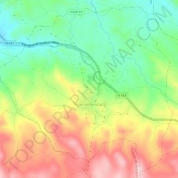
Name: Fuenteheridos topographic map, elevation, terrain.
Location: Fuenteheridos, Sierra de Aracena, Huelva, Andalucía, España (37.88900 -6.68720 37.92446 -6.63881)
Average elevation: 2,336 ft
Minimum elevation: 1,955 ft
Maximum elevation: 2,799 ft