
San Manuel topographic map
Interactive map
Click on the map to display elevation.
About this map
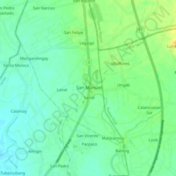
Name: San Manuel topographic map, elevation, terrain.
Location: San Manuel, Tarlac, Central Luzon, Philippines (15.75895 120.56683 15.83895 120.64683)
Average elevation: 72 ft
Minimum elevation: 43 ft
Maximum elevation: 131 ft
Other topographic maps
Click on a map to view its topography, its elevation and its terrain.
San Manuel
Philippines > Tarlac > San Manuel
San Manuel, Tarlac, Central Luzon, 2309, Philippines
Average elevation: 85 ft