
Nijlen topographic map
Interactive map
Click on the map to display elevation.
About this map
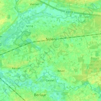
Name: Nijlen topographic map, elevation, terrain.
Location: Nijlen, Anvers, Flandre, 2560, Belgique (51.12240 4.59719 51.18108 4.72026)
Average elevation: 23 ft
Minimum elevation: 0 ft
Maximum elevation: 46 ft