
Embalse de la Cuerda del Pozo topographic map
Interactive map
Click on the map to display elevation.
About this map
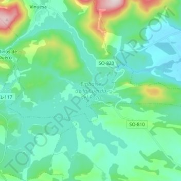
Name: Embalse de la Cuerda del Pozo topographic map, elevation, terrain.
Average elevation: 3,707 ft
Minimum elevation: 3,412 ft
Maximum elevation: 4,964 ft
Other topographic maps
Click on a map to view its topography, its elevation and its terrain.
Toranzo
España > Castilla y León > Soria
Toranzo, Soria, Castilla y León, España
Average elevation: 4,544 ft