
Bauche topographic map
Interactive map
Click on the map to display elevation.
About this map
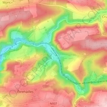
Name: Bauche topographic map, elevation, terrain.
Location: Bauche, Yvoir, Namur, Wallonie, 5530, Belgique (50.31446 4.90909 50.35446 4.94909)
Average elevation: 699 ft
Minimum elevation: 341 ft
Maximum elevation: 945 ft
Bauche se situe dans la vallée du Bocq, à une altitude de 120 m.