
Houtan Park topographic map
Interactive map
Click on the map to display elevation.
About this map
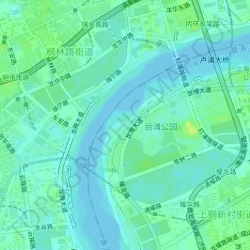
Name: Houtan Park topographic map, elevation, terrain.
Location: Houtan Park, Sanlin, Pudong, Shanghai, China (31.17877 121.46239 31.18839 121.47389)
Average elevation: 20 ft
Minimum elevation: -13 ft
Maximum elevation: 59 ft