
Gual Tinggi topographic map
Interactive map
Click on the map to display elevation.
About this map
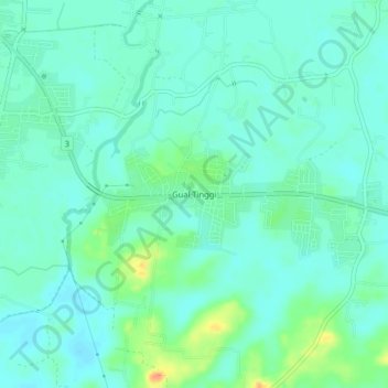
Name: Gual Tinggi topographic map, elevation, terrain.
Location: Gual Tinggi, Rantau Panjang, Pasir Mas, Kelantan, Malaysia (5.98317 101.97833 6.02317 102.01833)
Average elevation: 39 ft
Minimum elevation: 7 ft
Maximum elevation: 135 ft