
Lac Magog topographic map
Interactive map
Click on the map to display elevation.
About this map
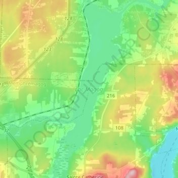
Name: Lac Magog topographic map, elevation, terrain.
Location: Lac Magog, Magog, Memphrémagog, Estrie, Québec, Canada (45.25064 -72.07100 45.34069 -72.02115)
Average elevation: 768 ft
Minimum elevation: 502 ft
Maximum elevation: 1,273 ft