
Sardoal topographic map
Interactive map
Click on the map to display elevation.
About this map
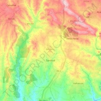
Name: Sardoal topographic map, elevation, terrain.
Location: Sardoal, Santarém, Médio Tejo, Centre, 2220, Portugal (39.50615 -8.19524 39.57384 -8.10834)
Average elevation: 659 ft
Minimum elevation: 217 ft
Maximum elevation: 1,086 ft