
Stepaside topographic map
Interactive map
Click on the map to display elevation.
About this map
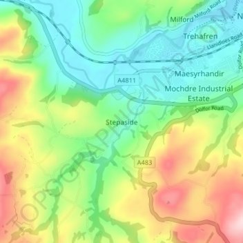
Name: Stepaside topographic map, elevation, terrain.
Location: Stepaside, Powys, Wales, SY16 4JQ, United Kingdom (52.47613 -3.37051 52.51613 -3.33051)
Average elevation: 643 ft
Minimum elevation: 344 ft
Maximum elevation: 1,165 ft
Other topographic maps
Click on a map to view its topography, its elevation and its terrain.
Llanidloes
United Kingdom > Wales > Powys > Llanidloes
Llanidloes, Powys, Wales, SY18 6BH, United Kingdom
Average elevation: 876 ft