
La Magdalena topographic map
Interactive map
Click on the map to display elevation.
About this map
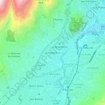
Name: La Magdalena topographic map, elevation, terrain.
Location: La Magdalena, Quito, Pichincha, 170170, Ecuador (-0.26127 -78.54812 -0.22127 -78.50812)
Average elevation: 9,524 ft
Minimum elevation: 8,990 ft
Maximum elevation: 11,467 ft