
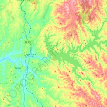
Santa Clara-a-Velha topographic map
Interactive map
Click on the map to display elevation.
About this map
Name: Santa Clara-a-Velha topographic map, elevation, terrain.
Average elevation: 522 ft
Minimum elevation: 121 ft
Maximum elevation: 1,125 ft
Other topographic maps
Click on a map to view its topography, its elevation and its terrain.
Fontinha
Portugal > Alentejo > Santa Clara-a-Velha
Fontinha, Santa Clara-a-Velha, Odemira, Beja, Alentejo Litoral, Alentejo, Portugal
Average elevation: 554 ft
Torre
Portugal > Alentejo > Santa Clara-a-Velha
Torre, Santa Clara-a-Velha, Odemira, Beja, Alentejo Litoral, Alentejo, 7630-521, Portugal
Average elevation: 856 ft