
Sciota topographic map
Interactive map
Click on the map to display elevation.
About this map
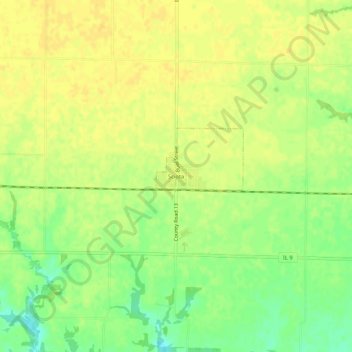
Name: Sciota topographic map, elevation, terrain.
Average elevation: 751 ft
Minimum elevation: 699 ft
Maximum elevation: 778 ft
Sciota is located at 40°33′39″N 90°45′06″W / 40.56083°N 90.75167°W / 40.56083; -90.75167Coordinates: 40°33′39″N 90°45′06″W / 40.56083°N 90.75167°W / 40.56083; -90.75167 (40.5608731, -90.7517996) at an elevation of 758 ft (231 m). According to the 2010 census, Sciota has a total area of 0.32 square miles (0.83 km2), all land.