
濮阳市 topographic map
Interactive map
Click on the map to display elevation.
About this map
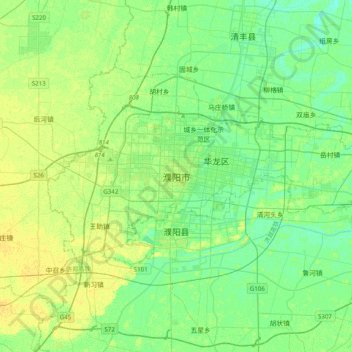
Name: 濮阳市 topographic map, elevation, terrain.
Location: 濮阳市, 华龙区, 濮阳市, 河南省, 457000, 中国 (35.60313 114.86341 35.92313 115.18341)
Average elevation: 177 ft
Minimum elevation: 154 ft
Maximum elevation: 203 ft
Other topographic maps
Click on a map to view its topography, its elevation and its terrain.