
Ploiești topographic map
Interactive map
Click on the map to display elevation.
About this map
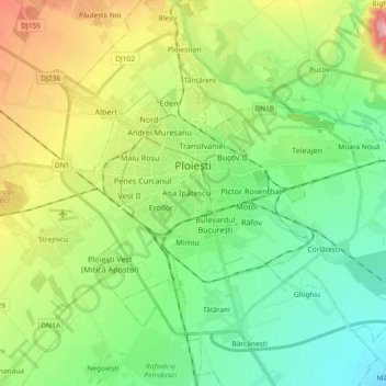
Name: Ploiești topographic map, elevation, terrain.
Location: Ploiești, Prahova, 100537, Romania (44.89614 25.91790 44.96842 26.10197)
Average elevation: 518 ft
Minimum elevation: 344 ft
Maximum elevation: 866 ft
Other topographic maps
Click on a map to view its topography, its elevation and its terrain.