
Stanstead-Est topographic map
Interactive map
Click on the map to display elevation.
About this map
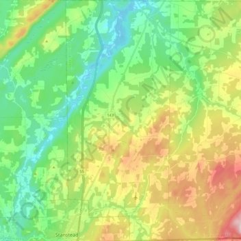
Name: Stanstead-Est topographic map, elevation, terrain.
Average elevation: 1,020 ft
Minimum elevation: 528 ft
Maximum elevation: 1,969 ft
Other topographic maps
Click on a map to view its topography, its elevation and its terrain.
Barnston
Canada > Quebec > Coaticook (MRC) > Coaticook
Barnston, Coaticook, Coaticook (MRC), Estrie, Quebec, Canada
Average elevation: 1,371 ft