
Thank you for supporting this site ❤️
Make a donation
Make a donation
Gear up for your next adventure:
As an Amazon Associate, this site earns from qualifying purchases at no extra cost to you.
Ighram topographic map
Click on the map to display elevation.
Thank you for supporting this site ❤️
Make a donation
Make a donation
Gear up for your next adventure:
As an Amazon Associate, this site earns from qualifying purchases at no extra cost to you.
About this map
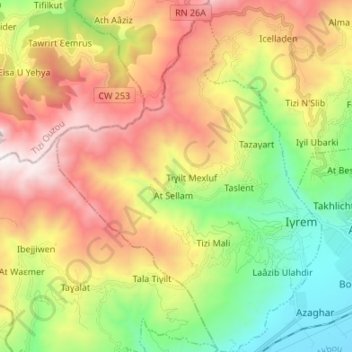
Name: Ighram topographic map, elevation, terrain.
Location: Ighram, Akbou District, Bejaia, 06057, Algeria (36.42206 4.41075 36.53009 4.51201)
Average elevation: 2,159 ft
Minimum elevation: 479 ft
Maximum elevation: 5,502 ft
Thank you for supporting this site ❤️
Make a donation
Make a donation
Gear up for your next adventure:
As an Amazon Associate, this site earns from qualifying purchases at no extra cost to you.