

Balkh topographic map
Click on the map to display elevation.
Balkh
Historically, the site of present-day Balkh was held in considerably high regard due to its religious and political significance in Ariana. A hub of Zoroastrianism and Buddhism, the ancient city was also known to the Persians as Zariaspa and to the Greeks as Bactra, giving its name to Bactria. As such, it was famously known as the capital of Bactria or Tokharistan. The Italian explorer and writer Marco Polo described Balkh as "a noble city and a great seat of learning" prior to the Mongol conquests. Most of the town now consists of ruined buildings, situated some 12 km (7.5 mi) from the right bank of the seasonally flowing Balkh River, at an elevation of about 365 m (1,198 ft).
About this map
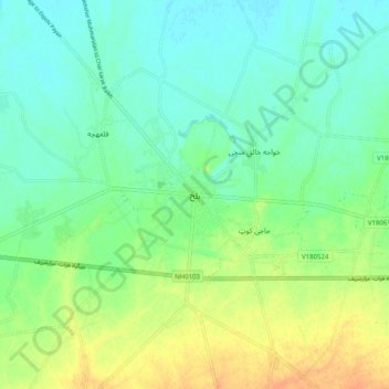
Name: Balkh topographic map, elevation, terrain.
Location: Balkh, Balkh Province, Afghanistan (36.71813 66.85798 36.79813 66.93798)
Average elevation: 1,142 ft
Minimum elevation: 1,099 ft
Maximum elevation: 1,214 ft