
Mont Bénara topographic map
Interactive map
Click on the map to display elevation.
About this map
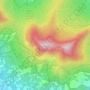
Name: Mont Bénara topographic map, elevation, terrain.
Location: Mont Bénara, Dembéni, Mayotte, 97660, Frankreich (-12.88007 45.16257 -12.87997 45.16267)
Average elevation: 1,076 ft
Minimum elevation: 217 ft
Maximum elevation: 2,031 ft