Geolocate

Poprad topographic map

Click on the map to display elevation.

Poprad

International Poprad–Tatry Airport from 1938, is an airport with the highest elevations in Central Europe. It also offers scheduled flights to London.

About this map

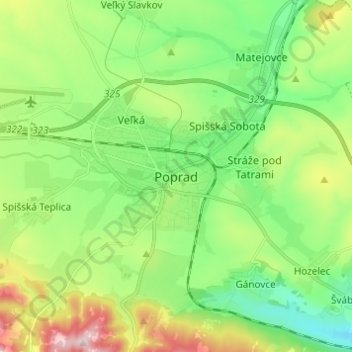
Name: Poprad topographic map, elevation, terrain.

Location: Poprad, District of Poprad, Region of Prešov, Eastern Slovakia, 05851, Slovakia (49.01415 20.25764 49.09415 20.33764)

Average elevation: 2,293 ft

Minimum elevation: 1,916 ft

Maximum elevation: 3,058 ft

Gear up for your next adventure:

🗻Climbing Gear Basics - Essential gear for beginner climbers
GPS Sports Watch - GPS watch for running, hiking and training
🚪Portable Camp Chair - Foldable chair for comfort at camp
🗃️Trail First Aid Kit - Essential kit for outdoor injuries and emergencies
🧥Waterproof Jacket for Hiking - Breathable and rugged rain jacket for outdoor excursions

As an Amazon Associate, this site earns from qualifying purchases at no extra cost to you.