
Puente Nacional topographic map
Interactive map
Click on the map to display elevation.
About this map
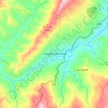
Name: Puente Nacional topographic map, elevation, terrain.
Location: Puente Nacional, Vélez, Santander, Colombia (5.83706 -73.71914 5.91706 -73.63914)
Average elevation: 5,725 ft
Minimum elevation: 5,112 ft
Maximum elevation: 6,716 ft