Geolocate

Camden topographic map

Click on the map to display elevation.

About this map

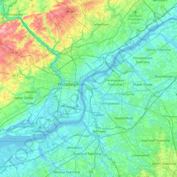
Name: Camden topographic map, elevation, terrain.

Location: Camden, Camden County, New Jersey, 08102, United States (39.78484 -75.27989 40.10484 -74.95989)

Average elevation: 102 ft

Minimum elevation: -13 ft

Maximum elevation: 509 ft

Camden County trails, hiking, mountain biking, running and outdoor activities

Gear up for your next adventure:

🥤Water Filter Bottle - All‑in‑one filter bottle for safe hydration
🪶Paracord Bracelet - Survival bracelet with built‑in tools
🌡️Handheld Weather Meters - Measure wind, temp, and pressure for safe mountain travel
🗃️Trail First Aid Kit - Essential kit for outdoor injuries and emergencies
📦Dry Bags Set - Waterproof storage for electronics and clothes

As an Amazon Associate, this site earns from qualifying purchases at no extra cost to you.