
Röhrsdorf topographic map
Interactive map
Click on the map to display elevation.
About this map
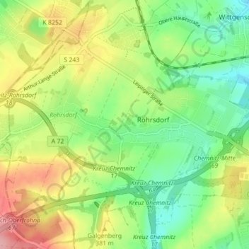
Name: Röhrsdorf topographic map, elevation, terrain.
Location: Röhrsdorf, Chemnitz, Sachsen, 09247, Deutschland (50.84706 12.80411 50.87832 12.87299)
Average elevation: 1,168 ft
Minimum elevation: 1,004 ft
Maximum elevation: 1,401 ft