
Le Pest topographic map
Interactive map
Click on the map to display elevation.
About this map
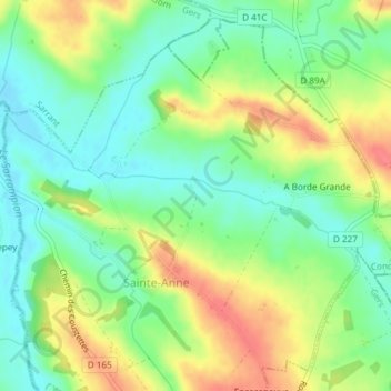
Name: Le Pest topographic map, elevation, terrain.
Average elevation: 505 ft
Minimum elevation: 420 ft
Maximum elevation: 627 ft
Other topographic maps
Click on a map to view its topography, its elevation and its terrain.
Le Pest
France > Occitania > Sainte-Anne > A Borde Grande
Le Pest, A Borde Grande, Sainte-Anne, Condom, Gers, Occitania, Metropolitan France, 32430, France
Average elevation: 531 ft