
Thank you for supporting this site ❤️
Make a donation
Make a donation
Gear up for your next adventure:
As an Amazon Associate, this site earns from qualifying purchases at no extra cost to you.
Chini topographic map
Click on the map to display elevation.
Thank you for supporting this site ❤️
Make a donation
Make a donation
Gear up for your next adventure:
As an Amazon Associate, this site earns from qualifying purchases at no extra cost to you.
About this map
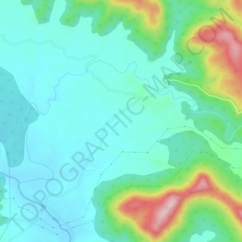
Name: Chini topographic map, elevation, terrain.
Location: Chini, Tamnar Tahsil, Raigarh District, Chhattisgarh, India (22.19449 83.51317 22.22241 83.57265)
Average elevation: 1,106 ft
Minimum elevation: 860 ft
Maximum elevation: 1,909 ft
Thank you for supporting this site ❤️
Make a donation
Make a donation
Gear up for your next adventure:
As an Amazon Associate, this site earns from qualifying purchases at no extra cost to you.