
Las Cuerlas topographic map
Interactive map
Click on the map to display elevation.
About this map
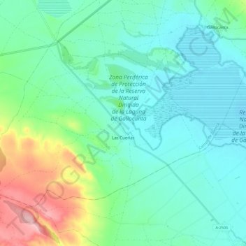
Name: Las Cuerlas topographic map, elevation, terrain.
Location: Las Cuerlas, Campo de Daroca, Zaragoza, Aragón, España (40.93622 -1.61745 40.99255 -1.50807)
Average elevation: 3,379 ft
Minimum elevation: 3,248 ft
Maximum elevation: 3,796 ft