
Thank you for supporting this site ❤️
Make a donation
Make a donation
Gear up for your next adventure:
As an Amazon Associate, this site earns from qualifying purchases at no extra cost to you.
Seddouk topographic map
Click on the map to display elevation.
Thank you for supporting this site ❤️
Make a donation
Make a donation
Gear up for your next adventure:
As an Amazon Associate, this site earns from qualifying purchases at no extra cost to you.
About this map
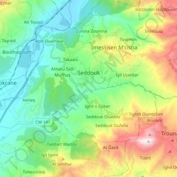
Name: Seddouk topographic map, elevation, terrain.
Location: Seddouk, Seddouk District, Bejaia, 06011, Algeria (36.49404 4.60146 36.57936 4.74576)
Average elevation: 1,588 ft
Minimum elevation: 295 ft
Maximum elevation: 4,485 ft
Thank you for supporting this site ❤️
Make a donation
Make a donation
Gear up for your next adventure:
As an Amazon Associate, this site earns from qualifying purchases at no extra cost to you.