
Caldas das Taipas topographic map
Interactive map
Click on the map to display elevation.
About this map
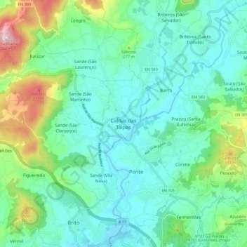
Name: Caldas das Taipas topographic map, elevation, terrain.
Location: Caldas das Taipas, Guimarães, Braga, 4805-133, Portugal (41.44688 -8.38392 41.52688 -8.30392)
Average elevation: 663 ft
Minimum elevation: 318 ft
Maximum elevation: 1,831 ft