Geolocate

Fannrem topographic map

Click on the map to display elevation.

About this map
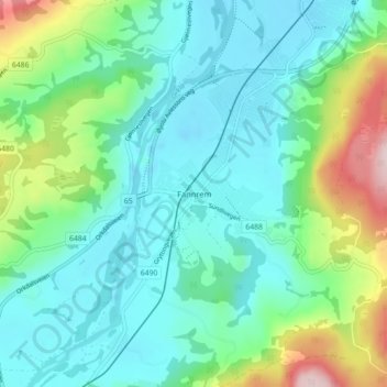
Name: Fannrem topographic map, elevation, terrain.

Location: Fannrem, Orkland, Trøndelag, 7310, Norway (63.24593 9.79404 63.28593 9.83404)

Average elevation: 253 ft

Minimum elevation: -23 ft

Maximum elevation: 1,076 ft

Other topographic maps

Click on a map to view its topography, its elevation and its terrain.

Røyrvik

Norway > Trøndelag

Average elevation: 1,890 ft

Sør-Skokkeløya

Norway > Trøndelag

Average elevation: 36 ft

Gear up for your next adventure:

💧Water Filtration Bottles - Safely drink from streams and lakes while exploring
🗻Climbing Gear Basics - Essential gear for beginner climbers
😴Insulated Sleeping Pads - Compact and warm pads for high-elevation camping
🎒Day Hiking Backpack - Lightweight backpack perfect for day trips and outdoor adventures
🛌Ultralight Sleeping Bags - Compact down bags for cold nights in the wilderness

As an Amazon Associate, this site earns from qualifying purchases at no extra cost to you.