Geolocate

Llandeilo topographic map

Click on the map to display elevation.

About this map

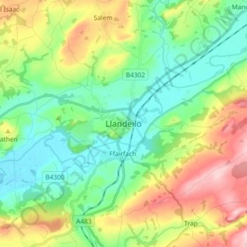
Name: Llandeilo topographic map, elevation, terrain.

Location: Llandeilo, Carmarthenshire, Wales, SA19 6EB, United Kingdom (51.84539 -4.03251 51.92539 -3.95251)

Average elevation: 335 ft

Minimum elevation: 56 ft

Maximum elevation: 879 ft

Other topographic maps

Click on a map to view its topography, its elevation and its terrain.

River Towy

United Kingdom > Wales > Carmarthenshire

Average elevation: 705 ft

Gear up for your next adventure:

📷Action Camera - Capture your outdoor adventures in HD
🪶Fire Starter Kit - Reliable fire starter for survival and camping
💧Water Purification System - Clean water on the trail with reliable purifiers
🕶️Glacier Sunglasses - Side shields to protect eyes from high-altitude snow glare
🪶Camping Sleeping Pad - Comfortable sleeping pad for backpacking

As an Amazon Associate, this site earns from qualifying purchases at no extra cost to you.