
Guatemala City topographic map
Interactive map
Click on the map to display elevation.
About this map
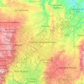
Name: Guatemala City topographic map, elevation, terrain.
Location: Guatemala City, Guatemala, 01004, Guatemala (14.46223 -90.67852 14.78223 -90.35852)
Average elevation: 5,112 ft
Minimum elevation: 2,595 ft
Maximum elevation: 8,061 ft