
Tenterden topographic map
Interactive map
Click on the map to display elevation.
About this map
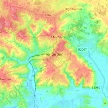
Name: Tenterden topographic map, elevation, terrain.
Location: Tenterden, Kent, South East, England, TN30 6QR, United Kingdom (51.03010 0.64883 51.11010 0.72883)
Average elevation: 108 ft
Minimum elevation: -3 ft
Maximum elevation: 259 ft