
Pine Ridge topographic map
Interactive map
Click on the map to display elevation.
About this map
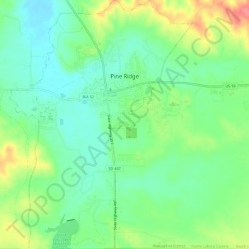
Name: Pine Ridge topographic map, elevation, terrain.
Location: Pine Ridge, Oglala Lakota County, South Dakota, USA (42.99979 -102.57833 43.04087 -102.53677)
Average elevation: 3,271 ft
Minimum elevation: 3,182 ft
Maximum elevation: 3,428 ft