
Quenast topographic map
Interactive map
Click on the map to display elevation.
About this map
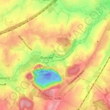
Name: Quenast topographic map, elevation, terrain.
Location: Quenast, Rebecq, Nijvel, Waals-Brabant, Wallonië, 1430, België (50.65121 4.13217 50.69220 4.18099)
Average elevation: 213 ft
Minimum elevation: -226 ft
Maximum elevation: 367 ft
Other topographic maps
Click on a map to view its topography, its elevation and its terrain.