
Cervantes topographic map
Interactive map
Click on the map to display elevation.
About this map
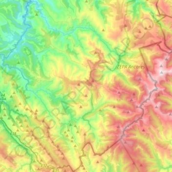
Name: Cervantes topographic map, elevation, terrain.
Location: Cervantes, Lugo, Galicia, España (42.71869 -7.10979 42.93382 -6.83368)
Average elevation: 3,255 ft
Minimum elevation: 1,099 ft
Maximum elevation: 6,473 ft