
Thank you for supporting this site ❤️
Make a donation
Make a donation
Gear up for your next adventure:
As an Amazon Associate, this site earns from qualifying purchases at no extra cost to you.
Tübingen topographic map
Click on the map to display elevation.
Thank you for supporting this site ❤️
Make a donation
Make a donation
Gear up for your next adventure:
As an Amazon Associate, this site earns from qualifying purchases at no extra cost to you.
About this map
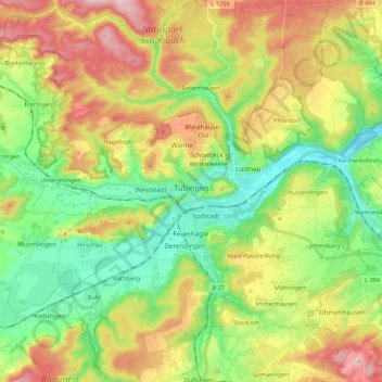
Name: Tübingen topographic map, elevation, terrain.
Location: Tübingen, Landkreis Tübingen, Baden-Württemberg, Germany (48.45058 8.96452 48.59377 9.13107)
Average elevation: 1,355 ft
Minimum elevation: 988 ft
Maximum elevation: 1,903 ft
Thank you for supporting this site ❤️
Make a donation
Make a donation
Gear up for your next adventure:
As an Amazon Associate, this site earns from qualifying purchases at no extra cost to you.