
Middlebourne topographic map
Interactive map
Click on the map to display elevation.
About this map
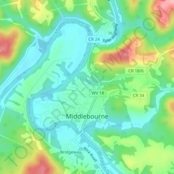
Name: Middlebourne topographic map, elevation, terrain.
Average elevation: 774 ft
Minimum elevation: 646 ft
Maximum elevation: 1,060 ft
Other topographic maps
Click on a map to view its topography, its elevation and its terrain.
Sistersville
United States > West Virginia > Tyler County
Sistersville, Tyler County, West Virginia, United States
Average elevation: 804 ft
Middlebourne
United States > West Virginia > Tyler County > Middlebourne
Middlebourne, Tyler County, West Virginia, 26149, United States
Average elevation: 869 ft