
Magdalena topographic map
Interactive map
Click on the map to display elevation.
About this map
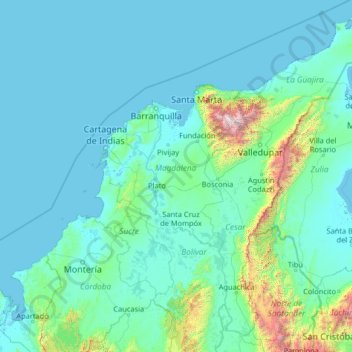
Name: Magdalena topographic map, elevation, terrain.
Location: Magdalena, Colombia (7.44001 -77.06001 12.56001 -71.94001)
Average elevation: 748 ft
Minimum elevation: -13 ft
Maximum elevation: 17,927 ft
Other topographic maps
Click on a map to view its topography, its elevation and its terrain.