
Zuidlaarderveen topographic map
Interactive map
Click on the map to display elevation.
About this map
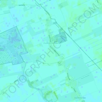
Name: Zuidlaarderveen topographic map, elevation, terrain.
Location: Zuidlaarderveen, Tynaarlo, Drenthe, Nederland (53.08475 6.71890 53.11645 6.77651)
Average elevation: 7 ft
Minimum elevation: -3 ft
Maximum elevation: 16 ft
Other topographic maps
Click on a map to view its topography, its elevation and its terrain.