
Acton topographic map
Interactive map
Click on the map to display elevation.
About this map
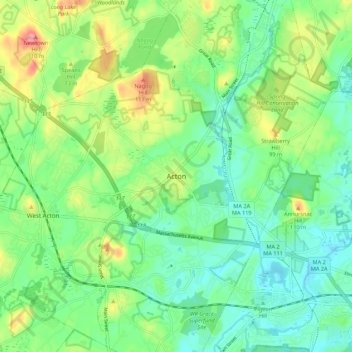
Name: Acton topographic map, elevation, terrain.
Average elevation: 213 ft
Minimum elevation: 105 ft
Maximum elevation: 440 ft
Other topographic maps
Click on a map to view its topography, its elevation and its terrain.
Nagog Pond
United States of America > Massachusetts > Acton > Kelley's Corner
Nagog Pond, Nonset Path, Village of Nagog Woods, Kelley's Corner, Acton, Middlesex, Massachusetts, 01718, United States of America
Average elevation: 259 ft