
Barika topographic map
Interactive map
Click on the map to display elevation.
About this map
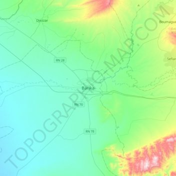
Name: Barika topographic map, elevation, terrain.
Location: Barika, Daïra Barika, Batna, 05022, Algérie (35.22450 5.21060 35.54450 5.53060)
Average elevation: 1,791 ft
Minimum elevation: 1,316 ft
Maximum elevation: 3,799 ft